10/31/2009

South Kalimantan

SOUTH KALIMANTAN

South Kalimantan/South Borneo (Indonesian: Kalimantan Selatan often abbreviated to Kalsel) is a province of Indonesia. It is one of four Indonesian provinces in the Indonesian part of Borneo. The provincial capital is Banjarmasin. The province boundaries are Makassar Strait in the east, Central Kalimantan in the west and north, the Java Sea in the south and a small part of East Kalimantan in the north.
The province had a population of 2.97 million in 2000, which grew to 3,45 million by 2008. In 2008 the number of visitors to the province was 339,000 of which 21,000 were international visitors, mostly from China, Philippines and India.South Kalimantan is one of the 4 provinces in Kalimantan (formerly called Borneo).
It is often called the Province of a Thousand Rivers. One is Barito river, the largest and the longest river in Indonesia which is more than 6,000 km long.

One of its tributary rivers is the Martapura river, which in turn has two tributary rivers of its own, the Riam Kanan and Riam Kiwa rivers. Barito connects with the Negara rivers which branches out into lesser rivers.
In 1990 the total population of South Kalimantan was 2,463,792 with a growth rate of about 1.8 % annually. 54 % of the population earn their living from agriculture, 15 % from public services, 13 % from the commercial sector and the rest from industry, transport,

The minority consists of some Javanese, Maduranese, Banjau, Bugenese, Chinese and Arabs. The culture and traditions are the assimilation through ages of the indigenous Dayaks, Malays, and Javanese. Then came the influence of Islam which was introduced by Arab and Persian traders. This can be seen from the people's way of life, especially in arts, such as dance, music, traditional dress, games and ceremonies.
Handicrafts are made from local raw materials. Jewelry made of precious and semi-precious stones are mostly made and sold in Martapura.
Rattan and bamboo weaving are from the Tapin district, handicrafts made of gold, silver, brass and iron are from the Hulu Sungai Selatan region. Sasirangan is a specific textile design where its dyeing is a specially of South Kalimantan. The designs and method are different from those of other parts of Indonesia.
Local fruits are among others : durian, rambutan, pineapple, etc.
The high rate of rainfall and adequate sunshine have made South Kalimantan fertile. Extensive forests with a large variety of trees make South Kalimantan one among the large wood producers in Indonesia. The region is well-known for its iron-wood, meranti, pinus and rubber.
South Kalimantan is connected with cities all over Indonesia through Syamsuddin Noor airport which is 25 km from Banjarmasin.
South Kalimantan can also be reached through the seaport of Trisakti and Banjarmasin harbor. To towns in Kalimantan there are plenty of good roads.
If waterways are preferable, go by boat along large rivers which go to almost every direction.
________________________________________
PLACES OF INTEREST
Banjarmasin and its surroundings

Banjarmasin is one of the biggest cities and enough important in Kalimantan, broadly regional 72 km2, 45 districts and 49 sub-districts, Banjarmasin is the provincial capital of South Kalimantan. Town region Banjarmasin stay between three provinces that is: South Kalimantan Province, Central Kalimantan Province, and East Kalimantan Province.
Banjarmasin city has written in world map since four centuries ago. During the Dutch colonization Banjarmasin city is area with autonomy and have representative area. And that take place is finite a period of Japan colonization. During transition (1945-1949) Banjarmasin become center power switchover since independence had proclamation. Banjarmasin now is preparing various areas covering: Administration, commerce, port town, education and tourism. Banjarmasin, the capital city, is the center of trade and tourism. It lies at the delta of the Barito river. The city is intertwined by numerous rivers of various sizes and lengths. The major rivers are Martapura and Nagara. The numerous rivers made the city get its nickname River City local people build traditional floating houses along the rivers and these houses are called "lanting", facing the rivers, which are made of wood or bamboo. Rivers have been very important for business and economic activities. This is one reason why there arefloating markets everywhere.
Making trips along the mighty Barito and Martapura rivers by "klotok boat or river bus", will give a unique experience. For longer trips one can hire speedboat.
Banjarmasin has developed into an industrial and touristic city. There are star hotels and 20 lesser hotels. For entertainment there are 21 movie theaters, karaoke centers, cultural theaters and restaurants serving local as well as international foods.
Kembang Island
This island is right in the Barito river, not far from a floating market. It is a conservation forest of about 60 hectares, inhabited by tame monkeys of Kalimantan species only. One of the species is called "bekantan" (nasalis larvatus).
It is mostly visited by Chinese Indonesians, as there is a small offering temple where they feed the monkeys.
It is believed that feeding the monkeys will bring good luck an fortune.
Kaget Island
Like Kembang island, Kaget island is also in the Barito river. From downtown it takes 1 1/2 hours by klotok boat or 1 hour by speedboat to get there.
This island is another forest conservation and is also inhabited by the "bekantan" monkeys and the Lutung (prebitis orisate), as well as many sorts of birds.
Diamond Digging at Cempaka & Martapura

Martapura is the capital of the Banjar regency, 36 kilometers southeast of Banjarmasin.Martapura, particularly the Cempaka district, is a well known producer of diamonds.Several mining villages exist, such as Lukaas and Sungai Tiung, lying five kilometers from Martapura.
People can be seen panning for diamonds at villages in the Cempaka district, eight kilometers from Martapura. Panners usually work in groups. Each group consists of the 16 to 18 people. The oldest person is usually named the head of the group. Before starting to work, they ask for guidance from "the expert one" the spirit of the village - so they will be led to the richest mining grounds.
First, the panners have to come to an agreement with the owner of the land, who has the right to 10 percent of the diamonds found. Then, several people are chosen to dig a hole, while others remove the soil or remove any water from the hole with buckets or with a pump. The holes are usually six to 10 meters deep. The sides are propped up with logs to prevent them from collapsing. As long as no diamonds are found, the digging continues in a horizontal direction so that tunnels are formed.
They work without schedule. It can start in the morning and continue until midnight, under the light of lanterns. Deposits are usually found at depths of 10 to 15 meters, in rocky earth layers. The dirt is taken out and washed. If diamonds are found, the head of the group must immediately be notified. The right to offer the diamond for sale belongs the group leader only.
In the past, it was strictly prohibited to talk to the person washing the gored. According to the local belief the diamonds become frightened and hide among the grains of sand. Women are strictly forbidden to step over the pits. The rough diamonds are referred to as "virgins".
South Kalimantan diamonds are classified into four types: petrous diamonds (yellow and of low quality), black diamonds (black and believed to posses mystical powers), white diamonds and pink diamonds (the best sparkling with the colors of a rainbow).
The Trisakti diamond was the most expensive diamond ever found in this region. It weighed 160 carats and belonged to the pink diamond category.
Diamonds are cut and polished in the Diamond Market of Martapura. Such places are always better known than the sites where the diamonds are found. That is why Martapura is also known as Diamond Town. There are several well known experts in diamond processing in Martapura.Cempaka is a small village 10 km from Banjarbaru, and 45 minutes from Banjarmasin. It is an old site of traditional diamond digging using very simple equipment.
The digging is a collective work by a group, usually consisting of one family and its close relatives.
In 1985 a large raw diamond of 116.7 carats was found in a hole of 15 meters deep.
Martapura is the center of diamond and precious stones polishing; it is also the center of diamond marketing. The town is 40 km from Banjarmasin.
The polishing work uses traditional as well as modern equipment.
Martapura Plaza is the center of diamond and jewelry marketing. Stone-craft of various origins and forms are easily found in the markets of Martapura.
Pieces of jewelry having with a large price range, start from as little as Rp.500,- up to millions of rupiahs.
Takisung Beach

About 10 km West of Pleihari is Tasikung beach. Folk entertainment is available. There is a hotel and a play ground for children.
Hulu Sungai Tourist Resort
Hulu Sungai is a vast region in the northern part of the province. Most areas here are swamps, but the eastern part is mountainous.
Loksado

Loksado is at the South Hulu Sungai district whose capital is Kandangan. The town is about 3 hours by car from Banjarmasin. The road is good. However, from Kandangan to Loksado, the road goes as far as Halunuk, a small village. Then the trip continues by motor cycle which takes a single passenger over a narrow foot-path.
The natural surroundings of the hilly region provides attractive sights for those who enjoy hiking and mountaineering. On the way, meet the local people with their original ways and cross the river over a suspended bridge.
Adventure River Rafting
The Amandit River which originates at Meratus runs through Loksado and meets the mighty Barito river further down.
Visitors usually use the river to get back after visiting Loksado. Those who enjoy rafting may venture the trip through numerous rocky rapids by traditional rafts made of bamboo or by rubber boats. The river trip starts at Loksado, 45 kilometers from Kandangan. When a motorcycle ride is preferred, it takes about 4 hours. Those who enjoy trekking through the forests of the hill, the trip takes 8-10 hours.
When a river trip is taken, start from Loksado to Batu Laki which is 56 km away. The trip can be made in two stretches. The first is from Loksado to Muara Hatip. The second is from Muara Hatip to Batu Laki.
The first stretch is not very challenging because the rapids are not very strong and ranks as grade 1 to 2 1/2. On the second one, the level of difficulty increases, while the rapids are higher and stronger at grade 3, such as Hawangan and Kandihin at the mouth of the river Muara Haring. The panorama along the river is fascinating.
________________________________________

10/28/2009

East Java


EAST JAVA


East Java (Indonesian: Jawa Timur, Javanese: Jawa Wétan) is a province of Indonesia. It is located on the eastern part of the island of Java and also includes neighboring Madura and islands to the east of it, as well as the Bawean islands. Cover area 47,922 km2 (18,503 sq mi) wuth Population 34,766,000 (2000), Density 725.5 /km2 (1,879 /sq mi) and have Ethnic groups Javanese (79%), Madurese (18%), Osing (1%), Chinese (1%). The administrative center of the province is located in Surabaya, the second largest city in Indonesia and a major industrial center and port. East Java has a variety of attractions, from temple sites to scenic beaches, a sand-sea, highland-lakes, volcanoes, marine gardens and wildlife reserves.


As the power in Central Java declined around the tenth century, powerful kingdoms rose in East Java to fill the vacuum. Between 1055 and 1222, the kingdom of Kediri prospered and expanded. During the reign of king Erlangga both East Java and Bali enjoyed a lucrative trade with the surrounding islands when their arts flourished.

Parts of the Mahabarata epic were translated and reinterpreted to conform closer to the East Javanese outlook and philosophy, and it was from this era that East Java inherited much of its treasure of temple art. In 1292 the Majapahit dynasty began an empire that was to dominate the entire archipelago, the Malay peninsula and part of the Philippines. Majapahit also established profitable trade relations with China and other countries of the South East Asian region. Today the open-air amphi theater at Pandaan tells some of the stories of this glorious past. Aided by the Java Ballet performances against a backdrop of distant volcanoes, any traveler will be easily enthralled by the East Java experience, capturing the spirit of the province's culture and scenery. Its capital, Surabaya is second to Jakarta in size, population and commerce. East Java is also the most industrialized province in the nation. Its economy is based on agriculture, fishery, oil industries, coffee, mangoes and apples.

Connected with the rest of Java by good motor roads and train services, there are also air services between Surabaya and other major cities in the country including Bali which is only half an hour's flight a way. It is also easily accessible by road and regular ferry from Bali and Java. The island of Madura, famous for its bull races, is part of the province of East Java, though it has its own traditions and language.
Magnificent mountain scenery include the crater and sea of sand at Mount Bromo, the "sulfur mountain" Welirang and rugged lien Plateau. Little of the Majapahit empire's former glory still stands in East Java to day with the exception of temple ruins and some archaeological discoveries. East Java's claim to fame in modern history is its vanguard role in the struggle for independence against colonial forces in 1945.
________________________________________
PLACES OF INTEREST

Surabaya


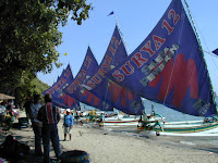
A booming city of over 3 million, Surabaya offers many good hotels, shopping centers and entertainment. Its well stocked zoological garden include several species of Indonesian fauna like "orang utan", komodo dragon and a collection of nocturnal animals.  Kalimas is an old traditional harbor for the world famous Bugis schooner 'pinisi' which sailed the Indonesian seas for hundreds of years. At present those praus can still be seen in their former glory with big colorfull sail.


Mpu Tantular Museum, well-stocked with archaeological art and cultural items from prehistoric times until independence. Across the Strait Madura, half an hour by ferry from Surabaya is the island of Madura, famous for its unique bull races held each year after the harvest season.  For groups, the races can be arranged on request. The Regional Tourism Offices of East Java provides a monthly calendar of even of the bull races.

Trowulan - Pandaan - Tretes

The surroundings of Trowulan village is believed to be the site of the ancient capital of Majapahit. Archaeological excavations in the area have recovered many terra-cotta ornaments, statues, pottery and stone carvings which are displayed at the Trowulan Museum. The map in the museum is a guide to nearby sites of historical interest.


The Candra Wilwatikta open-air theater in Pandaan 45 km south of Surabaya presents classical East Javanesse ballet performances on each full moon night from Juni to November.

The performances are based either on the Ramayana stories or East Java's legends and folklore. The backdrop of Mt. Pananggungan gives the performances an enchanting experience.
Up to ten km from Chandra Wilwatika is Tretes, one of the most beautiful mountain resorts of East Java. Hotels and roads cling to the hillside with swimming pools for a dip in the cool climate. Horses are also available for hire. Camping ground is available near the Kakek Bodo waterfall.


Malang

Ninety km south of Surabaya lies Malang, one of the most attractive town in Java. A strong sense of civic pride can be noticed from the well-maintained and painted becaks, the neat main square, buildings and streets. The cool climate is one reason why it is highly desirable among the East Javanese as a place to retire. 

Twenty km from Malang on the southern flank of Mt. Arjuna, are Selecta and Songgoriti, popular hill resorts with hot springs. 


 Five km nearby lies Batu, famous for its apples and flowers. Sports facilities at Selecta include horse riding, swimming, and tennis.  

Purwodadi Botanical Garden
Founded in 1941 for the study of plants growing under relatively dry conditions, the Purwodadi gardens lie about 30 km northeast of Malang just off the Surabaya-Malang main road on the lowest slopes of Mt. Arjuno at about 300 meters altitude. It covers an area of about 85 ha (212 acres).

Mount Kawi Fortune Hunting
A sage's grave on mount Kawi, near Malang, has for decades enjoyed unrivaled fame among those who seek to increase their worldly blessings through pilgrimages, offerings, and meditations besides hard work. Most of the pilgrims to Gunung Kawi are Indonesian Chinese, but even to unbelievers the place is worth a visit for its intensely Javanese atmosphere, with frequent wayang and gamelan performances and a quaint mixture of Javanese and Chinese influences.
The grave itself is built on a hilltop, but to its left and right of the long stairway is an assortment of sacred springs, Chinese houses of worship, flowers, and souvenir stalls.

Mount Bromo


One of the most exciting experiences is watching the sunrise from the crest of the Bromo volcano which is a three-hour drive from Surabaya, followed by a pony ride from the village of Ngadisari over a sea of sand to the foot of the volcano. Ascend the 50 steps to reach the rim.
On the vast expanse of sand, formerly a caldera, there are two volcanoes: the extinct Batok which is a perfect cone and the Bromo. Volcanic sulfur fumes and smoke still emanate from its depth, while during intense rumbling sounds the surrounding population who believes in the God of Bromo quickly brings offerings.

The annual offering ceremony of Kasada  is a colorful event where villagers from the surrounding areas bring their produce of sacrifice to the holy volcano.


Baluran National Park/Wildlife Reserve


Located at the eastern tip of East Java, just off the Surabaya-Banyuwangi main road, it is dry country-side of open forests and scrub land, bordered at the coast by marshes, swampy groves and white beaches. A land-rover or jeep is perhaps the only vehicle that can stand the long haul across these rugged grassy plains. Here, the banteng wild ox, deer and birds can be photographed in their natural habitat.

Kaliklatak
A privately owned plantation with an elevation of 450-750 m above sea level, on the slope of Mt. Semeru covering a 2.500 acres of land producing coffee, rubber, cocoa and spices. Cloves begin as flowers on the clove tree, cinnamon is ground bark, pepper grown on vines and nutmeg like golf-ball size pears hanging on broad leafed trees, are to be seen.
Touring the plantation is a trip through a vast, exotic spice machine process which ends with neat packages ready for export.


Sadengan

A famous wildlife reserve and feeding ground but of a smaller size than that of Baluran. Located in the forest of "Hutan Purwo", 81 km to the south of Banyuwangi. It is in possession of 700 wild buffaloes and varieties of other wild animals, all of which can be seen grazing in the late afternoon from the viewing tower.


Triangulasi

13 km south of Sadengan on the coast with a beautiful beach view. A nice location to watch the sunset and a place where turtles lay eggs.


Meru Betiri Reserve
After a 30 km very rough road which crosses half a dozen rivers through dense jungle and a rubber plantation, you finally arrive here on the southeastern tip of the province, where the last of the Javanese tigers had sought refuge. A hundred and fifty years ago Javanese tigers inhabited most of Java and was even considered a nuisance in some populated areas. But through the 1800s and early 1990s it was hunted mercilessly and its habitat destroyed by plantation builders. By the beginning of the Second World War it survived only in the most remote mountains and forests, and today, the last four or five live on the brink of extinction in a remote region.
The government and the World Wildlife Fund have mounted a determined effort to save the tigers and their environment. And to do so, the authorities are even prepared to relocate a few thousand humans. But Meru Betiri is not simply a tiger reserve. Wildlife of all kinds abounds, like black panthers, leopards and turtles.


Sukamade Turtle Beach

78 km south of Banyuwangi with its deep turquoise water, 250 kg sea turtles and a long beach, surrounded by vast cocoa, coffee and rubber plantations, are to be found here.


Temples

Between Surabaya and Malang is the town of Singosari where remnants of the early 13th century Singosari Kingdom include a temple and two gigantic statues of guardians to what many believed to be the main gateway to the capital of the kingdom. Jago temple dates back to 1268, and is one of the most attractive temples in East Java. Scenes from folk-tales as well as from the Mahabarata epic decorate the side panels.


Kidal temple, not far from Jago temple, was completed in 1260 to honor one of the kings, and is a gem of Singosari temple art.
Located 120 km south west of Malang and 11 km north of Blitar, is Penataran temple in the Singosari- Majapahit temple complex, dating from the mid fourteenth century. Its structures are laid on a vast field.
The temple terraces are decorated with Ramayana bas relieves. The main temple is well preserved.


Pasir Putih Beach, Situbondo

If you happen to be driving in a private car between Surabaya and Bali, this lovely beach may be worth visiting for a few hours or, if you prefer, an overnight stay to relax after driving long hours coming from either way. For you to enjoy here is fishing, sailing, swimming, snorkeling, wind-surfing, water-skiing or just simply sunbathing. Good seafood is available at some beach-front restaurants where nearby small souvenirs are for sale. This place is suitable for transiting tourists, rather than a destination point.


Mount Ijen Crater


Not exactly the most accessible of all craters, this Ijen crater may become of great interest to the adventurous tourist. It is located far enough from Bali as well as from Surabaya, whereas an overnight stay is recommended either at Banyuwangi if coming from Bali or at Bondowoso if coming from Surabaya. The trip to the crater should start early in the morning the next day because road accessibility only gets you up to 14 km from the crater which you have to do on foot, and up-hill for that matter.

Special about this crater is its wide gaping mouth having a diameter of 1 km, whereas its depth all the way to the bottom is 175 meters, where a turquoise lake is found with its impressive surroundings.


Ponorogo


Ponorogo is located southwest of Surabaya at a distance of 200 km. A bigger town closest to it is Madiun, which lies on the main highway between Surabaya and points west of it in Central Java. So, out of Madiun it would be a side trip to Ponorogo, if you care to witness the Festival Reyog, held here on the 17th of August each year, highlighting the area's traditional drama and dance. Otherwise you may want to visit Ngebel Lake nearby. Batiks and basketry of this region are also well-known.


Shopping Hints
Batik from Madura, brass lamps and ornaments, bamboo decorations, stone statues: bronze figurines, basketry, paintings.
Daily exhibition activities at the People's Amusement Park (T.H.R) and Surabaya Mall (metal handicraft, leather handicraft, embroidered needlework, woven handicraft, textile fabrics).
Batik, woodwork & fretwork, rattan work, wooden furniture, ceramics, onyx & marble-ware, plate-work, flower arrangement).


________________________________________

10/23/2009

Indonesia


EAST NUSA TENGGARA


East Nusa Tenggara is , in many ways different from the rest of Indonesia.

It is geographically, ethnically and culturally a border area where the transition from Asia to Australia and Micronesia takes places.
The islands of East NusaTenggara are formed by the protruding peaks of a mountain chain which begins in northern Sumatra, stretching across Java toward the east. But unlike Sumatra, Java and Kalimantan, which are separated from the Asian mainland by shallow seas, the islands of East Nusa Tenggara have apparently always been separated from the Asian landmass by deep sea-beds. The arid landscape of eastern and southeastern Nusa Tenggara is the result of hot and dry winds coming from the Australian continent. In many coastal areas not a drop of rain falls during most of the year. The rainfall varies between 50 mm and 200 mm a year.
Temperatures vary from hot in coastal areas (30 - 35 degree C) to very cool in mountainous areas (about 15 - 17 degree C).
The province of East Nusa Tenggara comprises 566 islands. The three main islands are Flores, Sumba, and Timor.
Flores, a long island located between Sumbawa and Timor, is strewn with volcanoes in a mountain chain dividing it into several regions with distinctive languages and traditions, scenic beauty, good beaches, and natural wonders. The name is Portuguese for "flower", as the Portuguese were the first Europeans to colonize East Nusa Tenggara.
Occupying a unique position at the junction of the Australian and Asian submarine ridges, between the two distinct fauna regions marked by the Wallace Line, here is one of the world's most dynamic marine environments with nearly every species of coral and tropical fish represented.
Predominantly Catholic, there are several examples of its Portuguese cultural heritage like the Easter Procession held in Larantuka, and the royal regalia of the former king in Maumere.
Sumba, formerly known as the Sandalwood island, is known for its horses and Sumba cloth. The island is famous for its arts and handicrafts, particularly the textile "ikat" weaving.
Sumba, however, is not for everyone. Neither the food nor accommodation are up to international standards. But if you are willing to make some sacrifices, you can see an authentic, ancient culture with none of the layers of Hinduism or Islam mostly found elsewhere in the country.

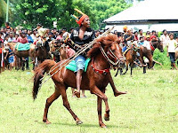
The island is roughly oval in shape. The greatest concentration of those who worship spirits (ancestral and those of the land) is found in West Sumba where two-thirds of the population hold on to their traditional belief. It is here where incredible rituals take place, o.a. the "pasola" where hundreds of horsemen fling spears at each other. (The government allows the ritual to take place, but the spears must be blunt).
Although some exist in East Sumba, it is in West Sumba that one can find a greater number of huge megalithic tombs and traditional thatched and peaked huts raised on stilts.

Many traditional activities, all with a part paying homage to the spirits, take place in the months of July through October. These include the building of "adat" houses and burials when sometimes hundreds of pigs, water buffaloes, horses, and dogs are sacrificed. Other ceremonies include the "pajura" or traditional boxing, the festivals for the lunar new year in October and November, and August 17, Independence Day, horse races and ritual dances.
Timor is the principal island in terms of population where the capital of the province, Kupang, is located.
Kupang is now being developed to be the gate-way to Nusa Tenggara. There are direct flights from/to Darwin-Australia.
Timor is rich in various cultures, beautiful sceneries, and a wonderful nature.
Made up of dry, rocky land, isolated communities, rolling cattle land, a variety of styles of architecture, Timor is basically something that possesses its own original characteristics.
Unlike some other parts of East Nusa Tenggara, the roads in Timor are generally good and public transportation is relatively well developed.
Tourist facilities are developing and improving in many ways; fair accommodations have been provided for, roads are improving, and tourist spots easier accessible.

PLACES OF INTEREST

Lasiana Beach


An ideal tourist recreation spot, near the capital city where the beach faces westward to watch beautiful sunsets.
Camplong
A lovely community about 45 km from Kupang with regular market days and a natural swimming pool, where traditionally people bathe, do their laundry, and socialize.
Camplong is also a forest reserve where some scarce animals, such as deer (Cervus Timorensis), parrots, monkeys, etc. in the reservation, are protected.
Kupang

The provincial capital of East Nusa Tenggara in western Timor with approximately 200.000 inhabitants makes it the largest urban center of the province. It is the center of government, business, trade, and education.

The only sandalwood oil factory in Indonesia is located in this town. Here one can see the distillation of sandalwood oil which is famous in East Nusa Tenggara.
The Museum in Kupang has on display items of historical and cultural value.
Semau Island

Thirty minutes by boat from Kupang this island is certainly worth to stay one whole day. No noise and uncrowded is what this island stands for.
It is a holiday village for everyone and a good places for relax as it offers a haven for those from the city. The surrounding waters is a paradise for snorkeling, swimming, and other water sports.
Barbecue on the beach is desirable. Bamboo cottages are available right on the white sandy beaches.


Maumere

A port town on the northeastern coast of Flores and a stopover on the way to Ende or to Larantuka. It is well connected by air with Kupang, Denpasar, and Ujung Pandang, and noted for its good beaches.
The bay of Maumere is considered a good diving spot (Flores Marine Resort) as it promises extremely rich marine life.

The resort is a paradise for all divers, underwater photographers, and for everyone interested in marine biology.
Ledalero museum at the out skirts of Maumere has an interesting collection of ethnological objects from the region. Visitors are welcome but advance arrangements should be made. Ledalero is also a name of a major catholic Seminary from where many of Flores priests originated.
Kelimutu

East Nusa Tenggara's natural wonder and one of Indonesia's most mysterious and dramatic sights can be found on top of this mountain, some 66 km from Ende, or 83 km from Maumere. It has a unique and spectacular view on its three crater lakes with their respective colors.

The colors, however, have changed continually since the eruption of Mount Iya in Ende in 1969. The surrounding villages are good places serving as bases for visits to Kelimutu, particularly those who wish to have a more leisurely pace and enjoy the views along the road between Ende and Maumere, or spend more time at Kelimutu. Those little villages are also known for their excellent weaving, all hand- made, still using natural dyes.
Labuanbajo

A little town inhabited by fishermen, lies at the extreme western part of Flores. The town serves as a jumping-off point for the trip to Komodo Island.

It is a beautiful area for water skiing, wind surfing, fishing, and many other marine activities. Pede Beach is an ideal place to do all this and from where sunsets are beautifully visible.
Soe

A town (110 km from Kupang) noted for its cool weather, beautiful flowers, and good fruits. Soe is otherwise a dull sprawl of wooden and corrugated-tin-roofed houses.
Ende
This town contains the home in-exile of former and first Indonesian president, Soekarno, while in banishment during the early period of nationalist movements in 1936. The house has been repaired and is today a museum.
Komodo Island

A small island of 280 square km, Komodo is located between the islands of Sumbawa and Flores. It is almost all hill and barren except for palm trees and some wood but it is famous for its giant lizards which are considered the last of their kind remaining in the world today. To many modern naturalists, East Nusa Tenggara is so particularly interesting, because of this unique species, called the Komodo Dragon. Called "ora" by the local people, Komodo "dragon" (Varanus Komodoensis) is actually a giant monitor lizard. Growing up to 3 to 4 meters in length, its ancestors roamed the earth up to about half a million years ago.

Komodos live on carrions of goats, deer, and even the carcasses of its own kind. The only human population on the island is at the fishing village called Komodo too who supplement their income breeding goats which are used to feed the lizards.

The Komodo is protected by law and though they are considered harmless, it is advisable to keep them at a distance. Komodo is now a nature reserve being part of a national park. It is home to a number of rare bird species, deer, and wild pigs, which are prey to the lizards as well.
To see the lizards in the day time, baits have to be set in the hinterland where local guides are necessary. The sea surrounding the island offers vistas of sea life, crystal clear waters, and white sandy beaches. The only accommodation available is in simple guest houses in the fishing village.
It is advisable to carry food supplies. The best time to visit the island is between March and June, and between October and December. Komodo is accessible from the sea only. Fly to Labuan Bajo, from where it is about 3-4 hours by boat to the island.
Larantuka

Larantuka is a neat clean seaport with a beautiful view. A little port nestled at the base of a tall hill at the eastern end of Flores, from where Solor, Adonara, and Lembata islands (the small islands near by) are visible across the narrow strait.Everything is within walking distance except for the pier where the boats leave for Timor (4-5 km from town). Even that is a pleasant walk if we do it early enough before it gets too hot.
An Old Portuguese cultural heritage like the Easter Procession is held in this town, and worth seeing. Flores people are very outgoing and friendly. Their bemos are brightly painted with murals on the sides and their radios are blasting the latest tunes. Lots of Catholic churches line the roads with a few mosques sprinkled in. Larantuka is a pleasant little town on the Far East end of Flores. There is a harbor in town and another one a few kilometers away where the ferryboat leaves to Kupang and Rote in West Timor. The boats going to Alor leave from the one in town. There are a number of tuna boats at the docks. They have a big square platform on the bow where fishermen line up with bamboo poles line up flipping hooked tunas.

Lamalera Whale Hunting

Lamalera on Lembata Island is a whaling village. The months of May to September make up the whale hunting season for the people of Lamalera. Using simple traditional tools as small row boats and the hand thrown harpoons, the hunters sail out to hunt these giant creatures of the sea. The catch is either consumed or sold.

Waikabubak
A neat little town in Western Sumba, full of old graves carved in motifs of buffalo-horns, man-heads, horses, nude men or women symbolizing social status or the wealth of the people. Right in the capital city of Waikabubak, you can see the following tombs: Kadung Tana, Watu Karagata, and Bulu Peka Mila. Tarung village, an important ceremonial center, is located on top of a hill, just a half kilometer to the west of Waikabubak.
There are several megalithic tombs. The front of many traditional houses are decorated with huge water buffalo horns from the animals sacrificed during rituals of years gone by.
Anakalang

The village is about 20 km from Waikabubak with its large graveyard (the largest megalithic tombs in Sumba). The tombs are always with unusual carvings. Anakalang is the site of the "Purung Takadonga", an important mass marriage festival held every two years, on a date determinated by the full moon.


Pasola
The most exciting ritual of Sumba is to be witnessed right here. Where else in the world can you see colorful horsemen trying to kill each other.

The ceremony is in February in Lamboya and Kodi, and in March in Gaura and Wanukaka. The main activities start several days after the full moon and coincide with the yearly arrival to shore of strange, multi-hued seaworms.


East Sumba
This region is better known for its "ikat" weaving. Near Waingapu, Kuta Beach is a good place to relax, and further down coast, near Baing (125 km from Waingapu), there is great surfing at Kalala Beach. The waves are best from December to May.
Shopping Hints

Traditional hand-woven cloth, one of the most outstanding traditional handicrafts, besides handicrafts of "lontar" leaves and sandalwood carvings, the sasando - the traditional musical instruments - either in miniature or actual size.
Accommodation
East Nusa Tenggara has several hotels but only small number with star ratings, where most of them are one-star hotels.


10/21/2009

East Kalimantan

EAST KALIMANTAN
A major producer of oil and timber, East Kalimantan is at present the most industrially advanced province of the island. Its population numbers less than two million, and the density figure of seven people per kilometer is among the lowest of Indonesia, although relatively high for Kalimantan. More than 80 percent of the area, or over 17 million hectares is covered by forest. This is where the "Black Orchid" and many other orchid varieties grow within the sheltered confines of nature reserves.
The Banjarese and Kutainese are mostly the coastal population, living in towns and cities. The Dayak peoples form the overwhelming majority of the population of the hinterland, who live in long-houses called umaq daru. It is customary for one whole extended family or even one clan to occupy one long- house. Each family is given a separate compartment with the chief of the clan occupying the central chamber. Guardian statues are normally placed in front of the long house to protect it against evil spirits who bring disease and bad fortune. Such long-houses, however, are gradually disappearing and many have been converted into meeting halls or stages for dance and music performances. The Dayaks are also known for their artistry, making beautiful cloths and ornaments for their traditional houses. The Tunjung Dayaks still make a kind of cloth called doyo, which is woven from certain plant fibers, used in the past in rituals. But now they are offered for sale to visitors. Oil and natural gas are found along the entire east coast, with refineries centered at Balikpapan and Bontang.
________________________________________
PLACES OF INTEREST
Samarinda Samarinda is known for its fine sarong cloth. The city shows some signs of being the capital of a prosperous province. New government offices and public buildings are rising everywhere. Samarinda has a number of modest but comfortable hotels.
Balikpapan Balikpapan, the center of Kalimantan's oil industry is also the gateway to East Kalimantan with air and sea connections to Jakarta and other major points in Indonesia. Even the trip to Samarinda, begins in Balikpapan. Living up to its importance, Balikpapan has a number of good hotels, including one of international standard, as well as recreation facilities. It has the second busiest airport in the nation after Jakarta, due to its strategic position.
Berau and Marine Tourism on Derawan island Found here are the remains of a king called the Keraton Gunung Tambur and The Keraton Sambaliung. Historic objects can be seen here. Derawan island is about 3 hours by a long boat from Tanjung Redep (The Capital of Berau Regency) or via Tarakan.
There are many rare animals such as the green turtle, the scarlet turtle, star fruit turtle and sea cow.Other things are rare species of marine plants, coral reefs, iguanas, sea birds, crab and the location for pearl diving.It is also good for scuba diving, fishing, swimming, and other water sports.
Bulungan It is one place for the adventure-seeking visitors. Things of historic value and ancient remains, art collections and traditional ceremonies, with a background of beautiful panoramas of the jungle and mountains are to be found here.
Bontang Located in the regency of Kutai with an area of about 200,000 ha, Bontang has a rare flora and fauna. The Kutai National Park near Bontang is worth visiting to see sceneries especially those at Beras Basah.
Tanah Merah Indah – Lempake This is a recreational park called Tanah Merah Indah-Lempake with a waterfall, located about 16 km from downtown Samarinda. It can be reached by car or public transportation
Tenggarong Tenggarong, up the Mahakam river from Samarinda, is the capital of the Kutai regency and was once the seat of the Kutai sultanate. The Sultan's palace on the riverside is now a museum where the old royal paraphernalia are kept, as well as an excellent collection of antique Chinese ceramics. Dayak statues can be admired in the yard. A curious thing about the royal paraphernalia is that they display a strong resemblance with Java's court traditions.
Every 24th of September, the former palace becomes a stage of dance and music performances given to celebrate the town's anniversary.
Tanjung Isuy This little settlement around Lake Jempang in the lake-studded East Kalimantan hinterland, has a traditional Dayak long-house which has been turned into lodges for visitors. The grave of a Benuaq Dayak chief lies aside the hamlet's only road. Visitors are usually given a traditional Benuaq Dayak welcome. The trip to Tanjung Isuy over the Mahakam river is a long but interesting one past floating villages and forest scenery. If you are lucky, you can watch a belian, or witch doctor, dressed in his skirt of leaves, cures his patients at night by performing the rites prescribed by ancestors to the frenzied accompaniment of gongs and drums. Many Benuaq Dayaks still prefer the old cures to the modern ones at government public health centers which are nearby.
Kalimantan comprises roughly the southern three-quarters of the equatorial island of Borneo, the third-largest island in the world after Greenland and New Guinea. Despite exploration and development, many areas of Kalimantan are almost untouched by the Western world. Maps of Kalimantan's river-laced interior still excite the imagination. The territory makes a unique travel experience for the more rough and ready traveller.
Tourist facilities are relatively undeveloped in Kalimantan, and visitors are few. Good roads run between Banjarmasin and Samarinda and around Pontianak, but rivers are the main transportation arteries. There are airports in the major cities, and airstrips throughout the interior serviced by commercial flights and missionary aircraft.
Melak - Kersik Luway Melak is a little village further upstream on the Mahakam river in the heart of the land of Tanjung Dayak. Not far from the village is the Kersik Luway nature reserve, where the "Black Orchid grows."
Muara Ancalong - Muara Wahau Dances of the Kenyah Dayak are often performed here for visitors at a traditional long-house. Also various handicrafts can be seen and purchased.
________________________________________

10/12/2009

South Sulawesi

South Sulawesi

South Sulawesi (Indonesian: Sulawesi Selatan) is a province of Indonesia. It is located on the southern part of the island of Sulawesi Cover area 72,781 km2 (28,101 sq mi) with Population 7,497,701 (2005), Density 103 /km2 (270/sq mi) and have Ethnic groups Bugis (42%), Makassar (25%), Toraja (19%), and Mandar (14%). Religion Majority is muslims with comunication languages is Buginese. The administrative center of the province is located in Makasar, the other large city in Indonesia and a major industrial center and port. South Sulawesi has a variety of attractions, from scenic beaches, a sand-sea, highland-lakes, volcanoes, marine gardens and wildlife reserves.

South Sulawesi is divided into following regencies with their capitals.

The strange orchid-shaped island of Sulawesi, can be recognised at first glance on any map of Indonesia. No other island is quite like it. The result of ancient geological upheavals, Sulawesi's twisted, elongated limbs have given rise to unique landscapes and an abundance of nature. Home to diverse and fascinating cultures, it is a land of exciting travel experiences.

The scenic seacoasts, rugged mountains and verdant rice-growing plains of South Sulawesi have their own unique fascination. With few sites of historical or artistic importance, the charm of the region lies in well-kept towns, and the extensive seacoasts where master shipbuilders construct massive wooden schooners, essentially Portuguese galleons, using only simple hand-tools and designs passed down by rote through the centuries.

PLACES OF INTEREST

The area around Ujung Pandang holds several sites of interest, from a spectacular coral reef and blinding white beaches offshore, to colorful highland market towns and the evocative ruins of vanished kingdoms.

The road leading up the west coast from Ujung Pandang to Pare-Pare is filled with awe-inspiring scenery and glimpses of Sulawesi's venerable traditions. A limestone range dominates this area, marked by intricate patterns of ridges and sheer cliffs honeycombed with caves.

The South Coast is the homeland of the Makassarese, the proud, indefatigable master seafarers who once regarded piracy as an honourable profession. The beaches are a forest of masts from the hundreds of fishing boats drawn up on the sand. The fortunate may witness exciting boat races and festivals to mark the departure of the fishing fleet. The sense of lost time is still felt in the rows of sturdy pinisi hulls being erected on the beaches.

Remnants of the great Bugis kingdoms of the pre-European era are found in Sulawesi's central fertile plain. Scattered throughout the region are reconstructed wooden palaces and gravesites, but the greatest attraction is the area itself, with verdant fields, attractive, colorful towns and glimpses of net fishing, buffalo-powered field preparation, hand threshing and other ageless activities of rural life.

Hanging like a teardrop off the southern tip of the peninsula, Selayar Island offers fine beaches and a glimpse of colonial life in the preserved Dutch architecture and general preindustrial ambiance of the towns and villages.

A splendid 2000-year-old Vietnamese DongSon drum, perhaps washed up from a nearby shipwreck, is kept in a wooden shed near a former royal palace.

Luwu, the horseshoe-shaped region capping the Gulf of Bone, is at once the most ancient and most modern region in South Sulawesi. Believed the site of the first Bugis kingdom, Luwu became an open frontier. with Javanese and Balinese transmigrants mixing with long-isolated local tribes to generate _ fascinating mixture of peoples and cultures. The most incongruous addition to the region is a relocated Canadian mining town at Soroako, built for expatriate mining experts but now populated mostly by Indonesian managers and professionals. The nickel mine and associated facilities have brought good roads and other modern facilities to Luwu, but the air of an untamed land, reinforced by the looming presence of the Central Sulawesi mountain range, remains.

UJUNG PANDANG

The gateway to Sulawesi is the historic port of Ujung Pandang. Long known as Makassar, Ujung Pandang is one of the few Indonesian cities to embrace the sea. The focus of the town is a long esplanade curling along the bay, with swaying palms, wide sidewalks and colourful shophouses their second-storey terraces offering a commanding view of the beach, bay and tropical sunsets. While this growing city has sprawled into the surrounding hills during recent decades, commercial and social activity remains centered within a few blocks of the waterfront. In the late afternoon and early evening hours most of the population seems to gather along the esplanade, strolling and chatting, snacking at any of the scores of teashops and roving food stalls, or simply enjoying the fresh sea breeze as the setting sun touches the horizon, silhouetting the masts and billowing sails of the schooners cruising the bay.

Photo. Night of Makassar

In modern Indonesia, Ujung Pandang has become the primary port and airline hub of the eastern archipelago, the thousands of remote islands being developed and incorporated into the mainstream of Indonesian society and economy. As in previous centuries, when Makassar was the commercial heart of Southeast Asian trade, Indonesians, other Asians and Europeans rub shoulders in the narrow alleys and jostle in the shops and markets. A trained ear will pick out dozens of languages on the streets, and a casual browse through the shops on Jalan Sumba Opu will reveal goods, handicrafts and antiques from all corners of the archipelago. More than any other Indonesian city, Ujung Pandang evokes the great age of maritime discovery, trade and adventure.

Photo. Losari Beach

Makassar was for centuries the main port of call for spice carrying ships. This harbour town most famous in the 15th century, has lost none of its allure. Today renamed as Ujung Pandang, this colourful now modern city is the capital of the Province of South Sulawesi, has first class hotels and is the entrance to many attractions in its hinterland.

For centuries the name Makassar has conjured up images of all that is exotic, of sailing ships and spice traders, and fortunes made and lost, of gold and bloody wars. It is home to the buccaneering Bugis, master shipbuilders whose elegant pinisi schooners can be seen in many harbours of Indonesia. These navigators and fearless sailors roamed as far as Australia and Madagascar long before their history was recorded.

TORAJA

Hidden away in verdant mountains is the fabled Tana Toraja, or Torajaland, where phenomenal funeral ceremonies draw visitors from around the world. While further south. where the hospitable and staunch Muslim Bugis are the largest population group, older pre-lslamic Hindu traditions surface in elaborate wedding rituals and their customs. Around the Bugis heartland of Bone, Soppeng and Sengkang, women sit at handlooms fashioning hand-processed silk into dramatic checked textiles of iridescent pinks, luminous greens, golds, yellows startling combination that seems to work magnificently well together.

Photo. Pallette cape and Arung palakka monument

The long drive from the lowlands to the mountain stronghold of Tana Toraja opens up a breath-taking new world. The rugged mountains and verdant valleys are home to a people whose love of religious spectacle is equaled only by their hospitality. With majestic panoramas, captivating villages and dramatic ceremonies, Tana Toraja is the undisputed highlight of any journey to Sulawesi.

Upgraded roads, an airport and several star-rated hotels have opened the Toraja highlands to visitors of all interests, budgets and schedules. The essence of the Toraja beliefs and way of life can be experienced without undue effort, as many interesting sites are clustered around the town of Rantepao, easily accessible by road.

A few minutes from Rantepao, artisans at Kete Kusu, a model Toraja settlement, produce bamboo carvings and other traditional handicrafts. The village itself has several well maintained tongkonan houses and rice barns.

Visitors unsure about the propriety of tramping around someone's village will be relieved to know that Kete Kusu has been converted into a living museum with the express purpose of displaying Toraja architecture and daily life. Other villages within sight of the roads, often sitting in an emerald sea of ricefields, display the Toraja penchant for baroque architectural adornment.

If the Toraja way of life is interesting, the way of death is a fascinating mix of ritual custom and spectacle. For the Toraja, the dead are as much a part of society as the living. At Lemo, cliffs rise precipitously from the ricefields like stonework condominiums. Crypts carved with prodigious manual labor high into the solid rock house the mortal remains of Toraja nobility. Set amongst the crypts, the striking tau-tau, wooden effigies representing the deceased, look impassively on the world below.

At Londa, a network of coffin-filled caves reaches deep into the limestone hills. Visitors expecting a solemn, well-kept grotto are often shocked and disturbed by skeletons tumbling out of rotten coffins, skulls and bones arranged, to Western eyes, according to some gruesome aesthetic. But the Toraja feel that since their ancestor's souls are residing in heaven, ensuring continued fertility in farm and field, it is appropriate that their earthly remains be on display for the pleasure of honored foreign guests.

While the valley between Rantepao and Makale provides a glimpse of Toraja life, the real Toraja lies in the surrounding mountains, accessible only on foot. In treks ranging from an easy day to a strenuous week, those with a moderate capacity for adventure can experience authentic Toraja village life in charming mountain hamlets. Even in the most remote mountain villages, visitors are welcomed openly. Long accustomed to foreigners stumbling unannounced into their settlements, village leaders will generally arrange overnight accommodation with a local family for a modest contribution.

South Sulawesi's natural beauty is a paradise of white sand beaches and undisturbed coral reefs, cool highlands and rushing waterfalls flecked with the technicolour yellows and shimmering blues of wild butterflies. The upland lush forests, filled with endemic species are made for trekking and thrilling white water rafting expeditions along the Sa'dan or the Lore Lindu rivers. Deep in the interior of the island are mist-swathed primeval mountains where clear and placid lakes are concealed within majestic highland forests

South Sulawesi is part of a huge island with so much to discover While two or three days is enough to see some amazing sights, here, more time is definitely advised.

Followers